
Kadir van Lohuizen: Putting stories into perspective

Photojournalist Kadir van Lohuizen feels that there are many big stories around the world that need to be told and that it is his responsibility to tell them in the right way.
The celebrated Dutch photographer has covered conflicts in Africa and elsewhere, but he is best known for his long-term projects, which have included stories on the seven rivers of the world, the diamond industry and migration in the Americas.
His works have won him lots praise and prizes, including two World Press Photo awards.
He is preparing to publish his next big project Where Will They Go, a story on the immediate impact of rising sea levels across the globe, in March.
“It’s a project that I started in 2012. In the project, I look into consequences of sea-level rise in the world. I went to different regions that have been or will be affected quite soon by the rise. I also researched where people will have to relocate,” Kadir says.
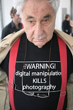
Kadir was in Jakarta last month to give an exclusive workshop at the Permata Photojournalist Grant (PPG), which was held by Bank Permata in cooperation with Dutch cultural center Erasmus Huis.
For the project, Kadir visited Bangladesh, Panama, Fiji, Kiribati and Papua New Guinea, and is planning to go to the US, UK and Maldives.
The 50-year-old photographer said he started the project after visiting a delta area in Bangladesh around three years ago, where he was struck by the apparent impact of rising sea levels.
“I became aware of how serious the issue was. Bangladesh expects to evacuate 30 million people by 2050 due to rising sea levels,” he says.
“In my previous project, I went to Panama and saw a number of islands that had already been affected and people had already been evacuated. The issue is more urgent than most people assume; it’s very much knocking on our doors.”
For the project, Kadir is collaborating with the New York Times.
“I think this is going to be big, which is a good thing because it is important for people to become aware of the issue,” he said.
“Too often we start to think about the problem when it has happened, but not before.”
Aiming to raise awareness in the general audience, Kadir hoped that the message would also reach politicians and policymakers.
“It’s going to be the biggest problem of the century. It’s not just islands disappearing but also sea water seeping into the mainland, causing soil to become saline, rendering people unable to grow crops and having more difficulty accessing clean water,” he said.
Kadir said his projects always start small. “I never wake up one morning and think I’m going to do a big project,”
“It always starts when I end up somewhere and realize what’s going on, then think that it should be bigger than just one story,” he said.
One such incident led to his Diamond Matters photobook, which details the progress of diamonds from the mines of Africa to the world of fashion.
In the early 1990s, he worked as a photojournalist in many conflict areas in Africa, including Angola, Sierra Leone, Mozambique, Liberia and Congo. From 1990 to 1994, he covered the transition in South Africa from apartheid to democracy.
“It was during that time that I started to realize that there’s a connection between mineral resources and the conflicts,” he said.
In 2004, he went back to Angola, Sierra Leone and Congo to portray the diamond industry, following the diamonds from the mines to the consumer markets in the western world. The exhibitions that resulted from this project were not only shown in Europe and the US, but also in the mining areas of Congo, Angola and Sierra Leone.
The book was awarded the prestigious Dutch Dick Scherpenzeel Prize for Best Reporting On The Developing World and the project was recognized with a World Press Photo Award.
Always attracted to the visual aspects of things, Kadir took his first pictures when he was 10. He then learned to develop film when he was 16.
“I built a darkroom in a cupboard of my parent’s home,” he recalled the days.
He then decided to study photography after completing high school in 1982.
“But I was rejected at the admission test, probably because of poor quality and motivation,” he said.
“After the rejection, I did not touch the camera for a few years; I was pissed off,” he added, smirking.
Kadir then got a job as a sailor and started a shelter for the homeless during the stint. After saving up enough money, he traveled to China in 1985.
After his far east travels, he picked up his camera again and discovered the power of the tool.
“I discovered that a lot of stories were not being told and that the camera can actually be a powerful weapon to tell story. Important moments in history are usually remembered in pictures not film or, sorry to say, written story,” he said.
As a journalist, Kadir feels as though he is just doing his part.
“I probably won’t be able change the world, but I can contribute something to better understanding,” he said.
Kadir wants to continue what he has been doing as long as he is capable of doing it.
“I have no retirement plan. I will stop when I’m physically not able anymore,” he says. “I hope that will take a long time.”
His works have won him lots praise and prizes, including two World Press Photo awards.
He is preparing to publish his next big project Where Will They Go, a story on the immediate impact of rising sea levels across the globe, in March.
“It’s a project that I started in 2012. In the project, I look into consequences of sea-level rise in the world. I went to different regions that have been or will be affected quite soon by the rise. I also researched where people will have to relocate,” Kadir says.
Kadir was in Jakarta last month to give an exclusive workshop at the Permata Photojournalist Grant (PPG), which was held by Bank Permata in cooperation with Dutch cultural center Erasmus Huis.
For the project, Kadir visited Bangladesh, Panama, Fiji, Kiribati and Papua New Guinea, and is planning to go to the US, UK and Maldives.
The 50-year-old photographer said he started the project after visiting a delta area in Bangladesh around three years ago, where he was struck by the apparent impact of rising sea levels.
“I became aware of how serious the issue was. Bangladesh expects to evacuate 30 million people by 2050 due to rising sea levels,” he says.
“In my previous project, I went to Panama and saw a number of islands that had already been affected and people had already been evacuated. The issue is more urgent than most people assume; it’s very much knocking on our doors.”
For the project, Kadir is collaborating with the New York Times.
“I think this is going to be big, which is a good thing because it is important for people to become aware of the issue,” he said.
“Too often we start to think about the problem when it has happened, but not before.”
Aiming to raise awareness in the general audience, Kadir hoped that the message would also reach politicians and policymakers.
“It’s going to be the biggest problem of the century. It’s not just islands disappearing but also sea water seeping into the mainland, causing soil to become saline, rendering people unable to grow crops and having more difficulty accessing clean water,” he said.
Kadir said his projects always start small. “I never wake up one morning and think I’m going to do a big project,”
“It always starts when I end up somewhere and realize what’s going on, then think that it should be bigger than just one story,” he said.
One such incident led to his Diamond Matters photobook, which details the progress of diamonds from the mines of Africa to the world of fashion.
In the early 1990s, he worked as a photojournalist in many conflict areas in Africa, including Angola, Sierra Leone, Mozambique, Liberia and Congo. From 1990 to 1994, he covered the transition in South Africa from apartheid to democracy.
“It was during that time that I started to realize that there’s a connection between mineral resources and the conflicts,” he said.
In 2004, he went back to Angola, Sierra Leone and Congo to portray the diamond industry, following the diamonds from the mines to the consumer markets in the western world. The exhibitions that resulted from this project were not only shown in Europe and the US, but also in the mining areas of Congo, Angola and Sierra Leone.
The book was awarded the prestigious Dutch Dick Scherpenzeel Prize for Best Reporting On The Developing World and the project was recognized with a World Press Photo Award.
Always attracted to the visual aspects of things, Kadir took his first pictures when he was 10. He then learned to develop film when he was 16.
“I built a darkroom in a cupboard of my parent’s home,” he recalled the days.
He then decided to study photography after completing high school in 1982.
“But I was rejected at the admission test, probably because of poor quality and motivation,” he said.
“After the rejection, I did not touch the camera for a few years; I was pissed off,” he added, smirking.
Kadir then got a job as a sailor and started a shelter for the homeless during the stint. After saving up enough money, he traveled to China in 1985.
After his far east travels, he picked up his camera again and discovered the power of the tool.
“I discovered that a lot of stories were not being told and that the camera can actually be a powerful weapon to tell story. Important moments in history are usually remembered in pictures not film or, sorry to say, written story,” he said.
As a journalist, Kadir feels as though he is just doing his part.
“I probably won’t be able change the world, but I can contribute something to better understanding,” he said.
Kadir wants to continue what he has been doing as long as he is capable of doing it.
“I have no retirement plan. I will stop when I’m physically not able anymore,” he says. “I hope that will take a long time.”
Rising Seas – NYTimes.com
Rising Seas
By CORAL DAVENPORT; photographs By KADIR VAN LOHUIZEN
Some areas of the globe are especially vulnerable to rising sea levels. As land recedes under advancing waters, governments are faced with the costs of building defensive seawalls and relocating coastal populations — and in some extreme cases, finding new homes for entire island nations. RELATED ARTICLE »
Slide Show


Kiribati consists of 33 tiny islands and atolls, some uninhabited, sitting just feet above sea level and spread over an expanse of ocean the size of India.
Kiribati

The low-lying islands of Kiribati, just a few feet above sea level, are on the front lines of climate change. Globally, sea levels have risen eight to 10 inches since 1880, but several studies show that trend accelerating. If carbon emissions continue unchecked, a recent survey of experts concluded, sea levels may rise about three feet by 2100.
That could inundate most of Kiribati by the end of the century, and the islands, home to some 100,000 people, are already feeling the impact. The government of Kiribati says the intrusion of salt water caused by rising sea levels has contaminated fresh water supplies and crop soil, and President Anote Tong has predicted that his country will become uninhabitable in 30 to 60 years. According to theUnited Nations High Commissioner for Refugees, all the residents of Kiribati, along with other low-lying island states such as the Maldives and Tuvalu, could be forced to flee as a result of climate change. “Entire populations could thus become stateless,” the agency wrote.
The remote nation, more than 1,200 miles south of Hawaii and 3,800 miles northeast of Australia, has already purchased6,000 acres on the neighboring island state of Fiji to protect its food security as the sea encroaches on its arable land — and possibly, in the future, to relocate its residents.
Slide Show


Icebergs in a channel between Greenland’s Eqip Sermia glacier and Ilulissat Icefjord, the most active glacier in the Northern Hemisphere. Greenland’s immense ice sheet is melting as a result of climate change.
Greenland

A growing body of research shows that climate change is rapidly melting the Greenland ice sheet. In 2012, satellite observations revealed an “extreme melt event” in which ice melted at or near the surface of 98.6 percent of the ice sheet. The summer melt season has been lengthening as well:Simulated reconstructions show that it now lasts 70 days longer than it did in 1972, and the extent of the ice melt in 2010 was twice that of the average in the early 1970s.
All of these factors increase the contribution of Greenland’s ice melt to the global rise in sea level. But while the effects of climate change threaten the lives and livelihoods of people in low-lying Pacific island states, they could be a boon in parts of Greenland. Some Greenlanders hope climate change will help them achieve independence from Denmark, which colonized the island in the 18th century.
The immense weight of Greenland’s ice sheet pushes the island down into the ocean, so as the ice sheet melts and the weight decreases, the island rises. Melting ice and warmer weather are reshaping Greenland’s geography, making once-frozen land arable. The thaw is also opening up access to formerly iced-over reserves of oil, zinc, gold, diamonds and uranium. There is a small but growing political movement in Greenland to harness the new wealth of resources as part of a push for independence.
Slide Show


The Kuna — about 40,000 indigenous people living on dozens of islands off Panama’s Caribbean coast — fear that their ancestral lands could be submerged within a generation.
Panama

The San Blas archipelago, a chain of more than 350 white-sand islands sprinkled across the Caribbean coast of Panama, has been home to the indigenous Kuna people for thousands of years. Now, rising sea levels and higher storm surges are flooding their villages. Scientists at the Smithsonian Tropical Research Institute estimate that sea levels around the islands are rising at a rate of about three-quarters of an inch annually, and that the islands will be underwater in the next 20 to 30 years.
The Panamanian government is developing a plan to relocate the Kuna to the mainland, but the fiercely independent group is distrustful of the government, and many are resisting the proposal.
“The government of Panama recognizes that many of the people don’t want to move,” said Scott Leckie, director ofDisplacement Solutions, a Geneva-based organization that works with people displaced by climate change. “The younger the person is, the more likely they are to accept the move. The most able-bodied and highly educated people will move first. Thus, the least employed, the most ill, the oldest and weakest and most disabled, the least willing to move, will be the ones left behind.”
Slide Show


Of the 50 states, Florida is the most vulnerable to rising sea levels, standing just a few feet above the current level. Miami is in an especially dangerous position because of its porous limestone foundation.
United States

While seas are rising globally, the phenomenon is not occurring at even rates around the world. A 2012 study by the U.S. Geological Survey concluded that sea levels along the East Coast will rise three to four times faster than the global average over the next century. While levels worldwide are expected to rise an average of two to three feet by 2100, they could surge more than six feet along the Atlantic seaboard. The study named Boston, New York, and Norfolk, Va., as the three most vulnerable metropolitan areas.
Another study found that just a 1.5-foot rise in sea level would expose about $6 trillion worth of property to coastal flooding in the Baltimore, Boston, New York, Philadelphia and Providence, R.I., areas. That raises huge questions about the fate of Boston Harbor, where developers have poured millions into construction projects. Planners are steeling for a future in which storm surges flood huge swaths of Boston. They have put together a climate action plan outlining how the city can better prepare for disaster.
Miami, one of the nation’s most populous cities, is built atop a porous limestone foundation on the South Florida coast, making it extremely vulnerable to rising sea levels, according to the federal government’s 2013 draft National Climate Assessment. As Arctic ice continues to melt, the waters around Miami could rise up to 24 inches by 2060, according to a report by the Southeast Florida Regional Climate Change Compact. Residents say they are already experiencing the effects as roads and outdated sewage systems flood. The porous limestone creates a unique threat as seawater seeps through the city’s foundations.
“You’re not necessarily getting water pouring up over a barrier — instead, it’s seeping through the limestone and coming up through drains,” said Leonard Berry, co-director of the Climate Change Initiative at Florida Atlantic University. “It’s already happening. And it’s not very pleasant.”
A study by the Florida Department of Transportation concluded that over the next 35 years, rising sea levels will damage smaller roads in the Miami area, and that after 2050, major coastal highways will also experience significant flooding and deteriorate as the limestone beneath them becomes saturated and crumbles.
Slide Show


A submerged burial ground in Fiji’s Togoru village, where the Dunn family has lived for generations. The family, of Irish descent, has built five seawalls, but each one has been knocked down by rising waters.
Fiji

Like its Pacific island neighbor Kiribati, Fiji is seeing the effects of the encroaching ocean, and the government has begun relocating residents from the archipelago’s outer islands and low-lying coastal areas to the larger mainland.
The government moved residents from the coastal village of Vunidogoloa after salt water ruined the region’s crop soil. Officials are also investing in other adaptation measures: They are building desalination plants and water tanks on the country’s vulnerable northern islands, while continuing to make plans to relocate people.
At the same time, Fiji knows its plight is not as dire as that of nations like Kiribati and Tuvalu, which scientists say will probably disappear by 2100. Fiji’s president, Ratu Epeli Nailatikau, has said he will welcome the fleeing populations of those countries, a gesture that could strain his nation’s own waning land and resources.
Produced by Joe Burgess, Hannah Fairfield, David Furst, John Niedermeyer, Matt Ruby and Shreeya Sinha.

Borrowed Time on Disappearing Land
Vluchten voor water
Rising Seas
Het klimaat verandert, de zeespiegel stijgt. Het KNMI voorspelde onlangs dat hier over een paar decennia een klimaat als in Bordeaux zal heersen: warmer, maar ook onstuimiger. Volgens klimaatdeskundigen zitten we nog wel even veilig achter onze dijken. Maar hoe staat het met de rest van de wereld? Voor zijn project Rising Seas reisde fotojournalist Kadir van Lohuizen de afgelopen jaren van het inmiddels half ondergelopen tropische Kiribati naar de uitgestrekte delta van Bangladesh en van Groenland naar het Verenigd Koninkrijk om te zien wat de gevolgen zijn van het wassende water. Waar gaan mensen naartoe die door het water worden verjaagd? In Kiribati, een uitgestrekt eilandenrijk in de Grote Oceaan, zag Van Lohuizen van nabij welk stil drama zich daar voltrekt, ver van de camera’s van de grote nieuwsmedia. De eilanden steken maximaal anderhalve meter boven de zeespiegel uit. Doordat het zeewater door de opwarming uitzet en ijskappen en gletsjers in rap tempo verdwijnen, wordt het steeds moeilijker voor de eilandbewoners om zich te handhaven. Binnen dertig jaar zal Kiribati zijn verzwolgen door de zee, voorspelt president Anote Tong.
Het Intergovernmental Panel on Climate Change (IPCC), waar duizenden klimaatwetenschappers samenwerken, voorziet voor ‘honderden miljoenen mensen’ in de laaggelegen gebieden in Bangladesh, Vietnam, India en China grote problemen door overstromingen en zware tropische stormen. Ook de vluchtelingenorganisatie van de VN (UNHCR) voorspelt dat de inwoners van Kiribati, maar ook die van de Malediven en Tuvalu, allemaal zullen moeten worden verplaatst omdat hun eilanden verdwijnen. Van Lohuizen: ‘Het is angstig om te zien hoe de zee oprukt in Kiribati. Bij hoog water staan al hele stukken onder water, dorpsbewoners proberen met zandzakken hun stukjes land te beschermen, maar veel helpt het niet. Omdat landbouwgronden verzilten en waterbronnen zout worden, kunnen ze niets meer verbouwen. Deze mensen, maar ook de boeren en vissers in de kustgebieden van Bangladesh, Papoea-Nieuw-Guinea of Fiji, worden vaak aan hun lot overgelaten. Met deze serie wilde ik ze een gezicht geven.’
Vijftig miljoen Bengalen
Nu door de opwarming van de aarde in de Himalaya gletsjers in hoog tempo smelten, voert de rivier de Ganges steeds meer water af. Hierdoor breken dijken en dammetjes in de uitgestrekte delta van Bangladesh. Die infrastructuur is door gebrek aan fondsen vaak dramatisch slecht onderhouden. Van Lohuizen liep er in de stromende regen over modderige dijkjes en zag hoe dorpsbewoners met provisorische middelen probeerden gaten in dijken te dichten.
En dan zijn er nog de steeds heviger stormen en cyclonen en de stijgende zeespiegel waardoor de oceaan steeds verder oprukt en ook hier landbouwgebieden door verzilting waardeloos worden. De bewoners rest net als in Kiribati niets anders dan te verhuizen. In totaal gaat het om maar liefst vijftig miljoen Bengalen die in de nabije toekomst elders moeten gaan wonen. De afgelopen jaren ontvluchtten al 6,5 miljoen mensen het wassende water. Waar moet die enorme mensenmassa naartoe? Bangladesh is een van de dichtst bevolkte gebieden in Azië. De regering zette relocatieprojecten op in hoger gelegen gebieden, maar ook daar wonen al mensen, vaak behorend tot minderheden. Velen vonden dan ook een nieuw heenkomen in de krottenwijken rond de hoofdstad Dhaka. Maar ook de Bengaalse hoofdstad wordt al bedreigd door het oprukkende water.
Sandy
Van Lohuizen zette het Rising Seas project op in samenwerking met The New York Times. Daar waren ze verbaasd dat hij ook naar Boston wilde. Hoezo waren er ook problemen in de VS? Aan die vragen kwam een einde na de enorme ravage die de storm Sandy in de winter van 2012 aanrichtte. Hierbij werden de stad New York en de kustlijn van de staat New Jersey zwaar getroffen. Boston bleef overigens als door een wonder gespaard. Sindsdien lijken de vooral in Republikeinse kringen alom aanwezige klimaatsceptici enigszins in het defensief te raken. President Barack Obama, die de eerste vier jaar op zijn handen leek te zitten als het om klimaatbeheersing ging, is nu eindelijk in beweging gekomen. In juni vaardigde hij een decreet af dat de 600 kolencentrales in het land dwingt hun uitstoot voor 2030 met 30% terug te brengen – de plannen moeten voor juni 2016 binnen zijn. Dit zal er naar verwachting toe leiden dat honderden centrales hun deuren zullen sluiten, omdat de aanpassingen om CO2 af te vangen veel geld kosten. Het is nu afwachten of de regels overeind blijven tijdens de rechtszaken die de energiebedrijven ongetwijfeld zullen gaan aanspannen.
Steden als New York en Boston hebben niet gewacht op het tot op het bot verdeelde Washington. Daar worden – vaak in samenwerking met Nederlandse ingenieurs – plannen ontwikkeld om verdedigingswerken te bouwen die de zee op afstand moeten houden.
Klimaatvluchtelingen
Hoe actueel het project van Van Lohuizen is, bleek toen half augustus de eerste klimaatvluchtelingen ter wereld werden erkend. Het ging om een gezin uit Tuvalu, ook een eilandengroep in de Grote Oceaan. Ze woonden al zeven jaar illegaal in Nieuw-Zeeland en hadden geprobeerd toegang te krijgen tot Australië. Dat werd keer op keer afgewezen, omdat klimaatvluchtelingen niet onder het Vluchtelingenverdrag van de Verenigde Naties vallen. Daarom dienden ze deze keer op ‘humanitaire gronden’ een verzoek in bij de Nieuw-Zeelandse regering. Niet alleen het klimaat, maar ook het feit dat familieleden wel legaal in Nieuw-Zeeland waren en er weinig kans was op werk op Tuvalu brachten de rechter ertoe nu wel een vergunning te verstrekken.
Voorlopig zal het moeilijk blijven om op grond van klimaatverandering legaal toegang te krijgen tot een ander land. De Amerikaanse minister van Buitenlandse Zaken John Kerry zegde de verdwijnende eilandgemeenschappen in de Stille Oceaan geld toe om zich te wapenen tegen het water, maar over de toegang voor klimaatvluchtelingen zweeg hij wijselijk. De westerse wereld zit niet te wachten op nog meer mensen die op drift zijn geraakt. Toch zal de wereldgemeenschap op termijn met een oplossing moeten komen: de komende decennia zullen misschien wel honderden miljoenen mensen het gezin uit Tuvalu volgen. En niet alleen in Azië. In Noord-Afrika zal het zo droog en heet worden dat van daaruit grote vluchtelingenstromen richting Europa op gang zullen komen. Voedselprijzen zullen tot recordhoogte stijgen. We staan aan het begin van iets dat zal uitgroeien tot een ‘wereldwijde noodtoestand’, zei directeur Craig Johnstone van UNHCR al in 2008.
Verenigd Koninkrijk In Skipsea, een dorp in Noordoost-E leggen verdedigingswerken aan. Bewoners krijgen vooralsnog geen compensatie en weigeren te vertrekken. Papoea-Nieuw-GuineaDe Carteret-eilanden , behorend tot Papoea-Nieuw-Guinea, zijn wellicht onbewoonbaar. Zoetwater-bronnen zijn verzilt, de bevolking kan er geen groente meer verbouwen en lijdt honger. Ze zullen worden geëvacueerd naar Bougainville, een ander eiland van Papoea-Nieuw-Guinea. -Nieuw-Guinea Op de atollen van de afgelegen eilandstaat Kiribati in de Stille Oceaan leven 100.000 mensen. Die moeten volgens de VN binnen 30 tot 60 jaar waarschijnlijk allemaal worden geëvacueerd. De regering heeft bij buurland Fiji een stuk land gekocht van de Anglicaanse kerk. Om voedsel te verbouwen, en als toevluchtsoord. De kustlijn van veel -eilanden,, kalft af, mede door het kappen van mangrove-bossen. Door afnemende regenval en verzilting worden zoetwater-bronnen onbruikbaar. De regering is al begonnen met het verplaatsen van complete dorpen.
© foto’s Kadir van Lohuizen/Noor


Geen opmerkingen:
Een reactie posten